The South Mountain Reservation is home to a complex network of trails, including the Mayapple Loop Trail.
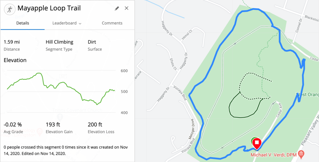
The Mayapple Loop Trail is a short, moderately difficult trail at the northern most tip of the South Mountain Reservation. It’s located in West Orange, north of Northfield Ave. The loop is about 1.6 miles long and it circles Mayapple Hill.
I’ve never been on the Mayapple Loop Trail before today, and I thought it was time to check it out. So let’s explore the Mayapple Loop Trail.
Accessing the Mayapple Loop Trail
If you’re accessing the trail by car, you’ll need to take Northfield Ave westbound and turn right up Cedar Ave – right after the light at Pleasant Valley Way. Cedar Ave climbs steeply to the top of the hill, where there is a parking lot.
Cedar Ave circles the hill one way, and it exits the reservation onto Pleasant Valley Way. If you’re accessing the trail by foot, you can also walk up Cedar Ave this way. There is no signage here to indicate that it’s an entrance to the trail and there’s a “Dead End” sign.
Mayapple Trail also connects with the Lenape Trail. If you’re traveling northbound on the Lenape Trail through the South Mountain Reservation, you’ll intersect the Mayapple Trail shortly after crossing Northfield Ave. If you continue along the Lenape Trail, you’ll join with the Mayapple Trail for a short while before continuing north towards Eagle Rock Reservation.
Since I can jog to the reservation from my house, I chose to enter by foot. I ran along the westbound side of Northfield Ave and turned onto Cedar Ave. If you choose to do this, just know that it is a very steep climb – about 150 feet over less than a quarter of a mile.

Exploring the Mayapple Loop Trail
The trail is a loop, so you can join it in multiple places. I joined the trail at the point where it intersects Cedar Ave on the way up from Northfield Ave. If you were to walk back down Cedar Ave a short ways from the parking lot, you’d see this trailblaze on the righthand side.
There’s also a short walking path that exits the parking lot to the southeast, and you can use it to join the trail over there. You’ll end up in the same place, eventually.
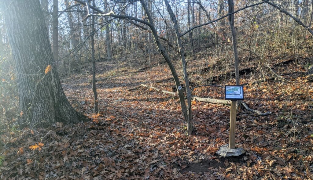
Almost immediately after joining the trail, I came across this map on a sign post. You can see the trail blaze for the Mayapple Trail (the white square with a blue circle) straight ahead. This is one of the two points at which the Lenape Trail crosses the Mayapple Trail, and you could take it south to the rest of the Reservation.
I took a moment to get my bearings on the map, since I’d never been on the trail before. And then I went on ahead.
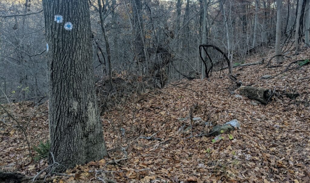
There was a weird little left turn, followed shortly by another right turn, that wasn’t well marked. But I managed to find a trail blaze and keep going. From there, the path was quite narrow and bordered by vegetation, so you couldn’t really go anywhere but straight.

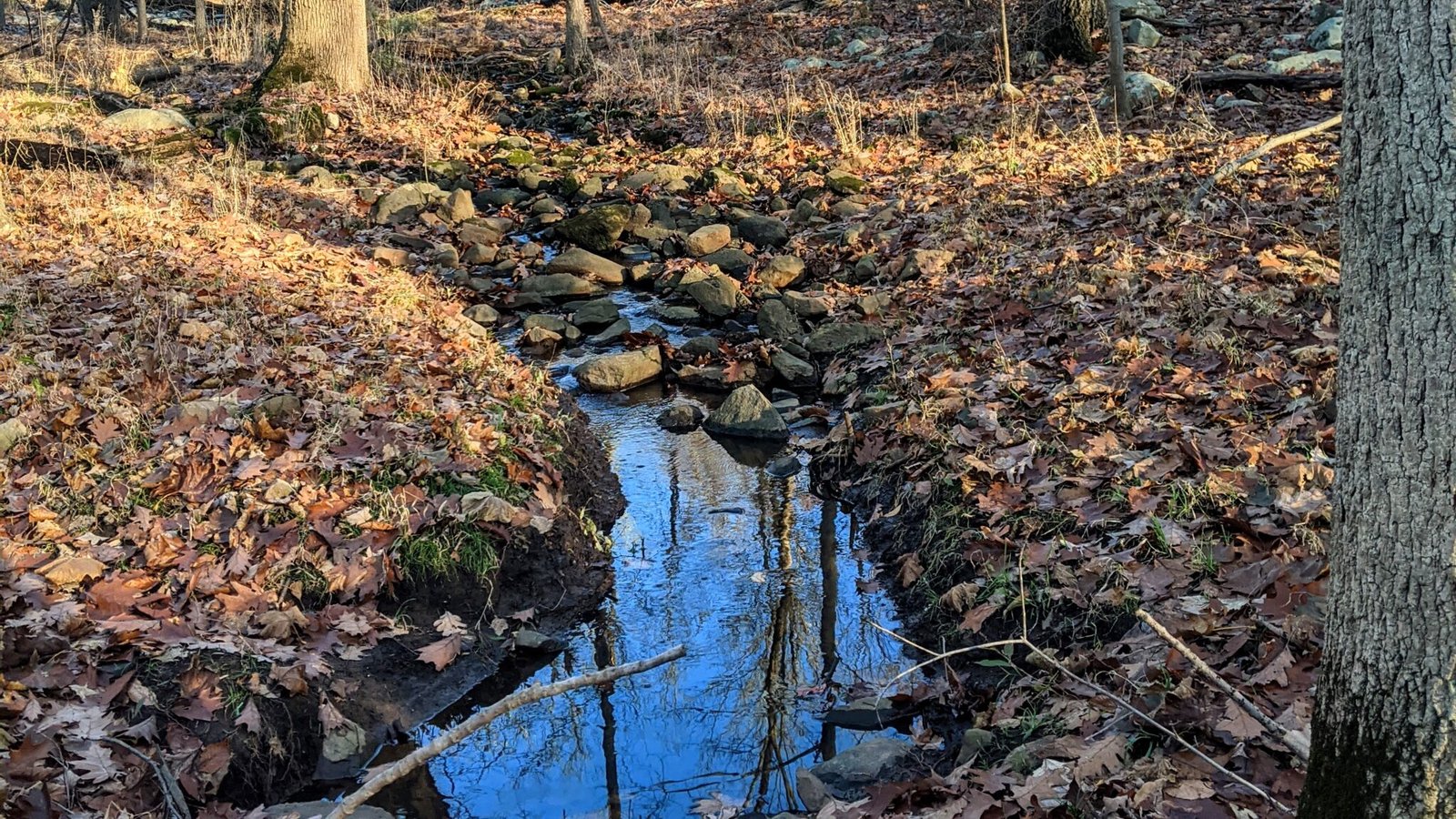
I was out on this trail in mid-November, and the trees had lost almost all of their leaves. As a result, you can see pretty far through the trees.
On this part of the trail, there were some rather uninspiring views of the Vizcaya Condos. I imagine it would be blocked out by the leaves once the foliage grows in in the spring.

Continuing further north along the trail, it will eventually widen out a bit. Up until this point, it was strictly single file. For the next short while, it will be a wide, clear road.

At the northern most end of the loop, the Mayapple Trail will briefly join with the Lenape Trail. You’ll see the yellow blaze of the Lenape Trail along with the white and blue blaze of the Mayapple Loop Trail.
If you were to follow the Lenape Trail – turning back and to the left – you would continue along it north and eventually get to Eagle Rock Reservation.
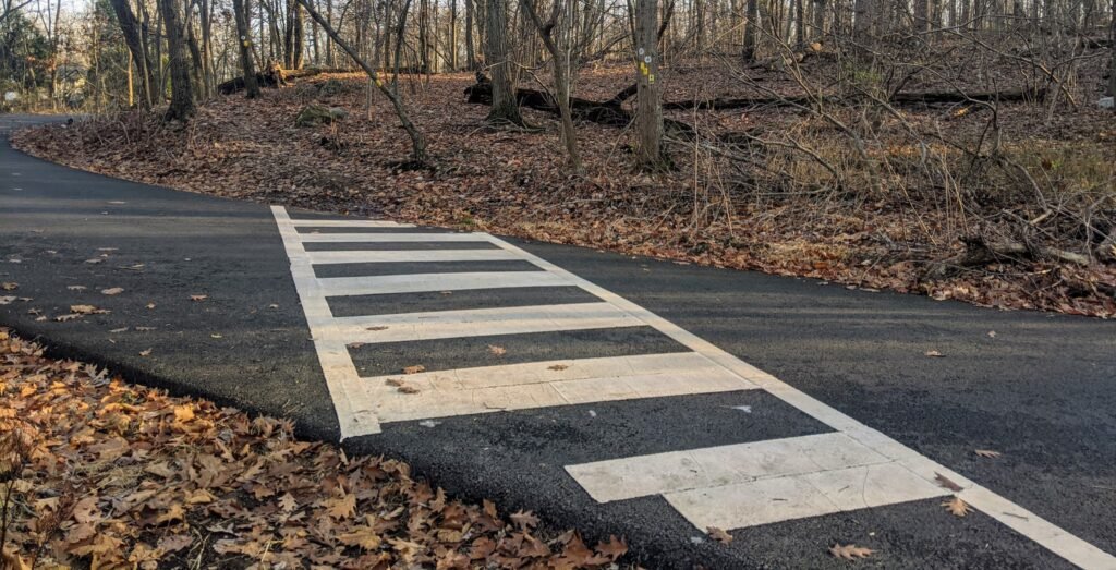
I wasn’t in the mood for that long of a run, so I stayed on the Mayapple Trail Loop. A short while later, the trail crossed Cedar Ave at this cross walk. If you were to turn left and continue down Cedar Ave, you’d exit the Reservation and end up on Pleasant Valley Way.
Although you see both the Mayapple Trail and Lenape Trail blazes here, they split just after this. The Lenape Trail will split off to the right, and the Mayapple Trail will continue to the left along Cedar Ave.
Before long, the Mayapple Loop Trail will cross Cedar Ave again and it will descend down quite steeply. Pay close attention to marked turns, like the one in the picture above. The trail will double back on itself a few times.
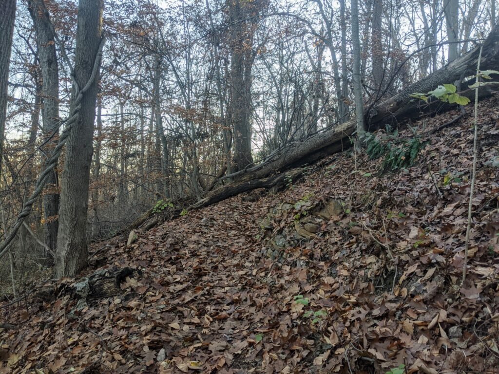
After a short descent into the valley, the trail will start to climb again. It will do so fairly quickly, and there will be another sharp turn or two – like the one in the picture above. I imagine this would be easier to navigate without leaves covering the trails.
It’s also worth pointing out that this part of the trail has a fairly steep drop off to the left. I wouldn’t say it’s particularly dangerous, but do be careful of your footing. I know I wouldn’t want to slip and tumble down that hill.
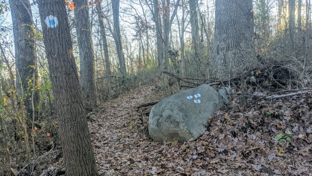
After climbing out of the valley, I came across this rock with a marked trailhead. Turning right here would take you up a short walking path to the parking lot.
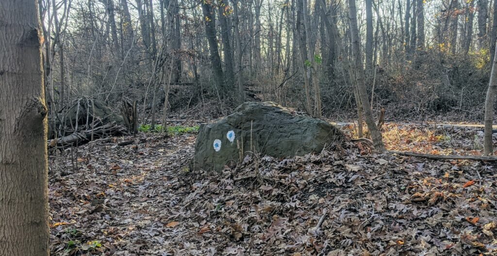
In my case, I had run up Cedar Ave to get to the trail, so I continued ahead. It wasn’t much farther until I saw another rock indicating a turn in the trail. This was where I had started, and I turned left to jog down Cedar Ave and head home.
Final Thoughts on the Mayapple Loop
The Mayapple Loop trail was a nice, moderately difficult trail. It was a bit short – 1.6 miles – but you could continue around it 2 or 3 times if you want a longer run.
One thing I don’t like about it is that it is somewhat separated from the rest of the Reservation. Unless you’re traveling up the Lenape Trail, it doesn’t easily connect with other trails to make for a longer run.
This would, however, make a wonderful short hike for some beginner hikers or younger children. Depending on how quickly you go, you could probably finish the hike in 30 to 45 minutes.
If you’re looking for other running or hiking trails in the area, check out my other posts about trails in the South Mountain Reservation.
And if you’ve never tried trail running, check out this guide to trail running.
Have you been on the Mayapple Loop Trail? What did you think of it?