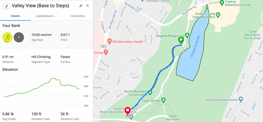
The South Mountain Reservation is home to a complex network of hiking trails as well as some paved running routes, including Valley View Drive and Brookside Drive.
Brookside Drive is a fairly busy road, but on Sunday mornings it is closed to vehicular traffic – providing an extra wide, paved, running and biking route.
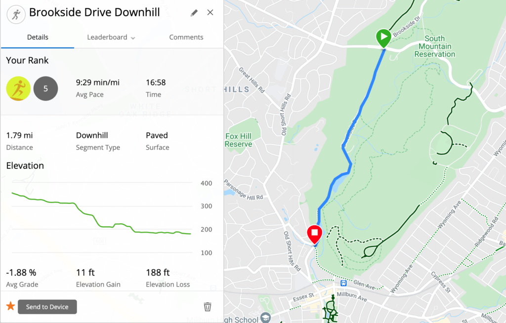
Together, these two roads meander through the Reservation for about three miles. They make a great building block for an out and back long run, and they have a decent elevation gain over the full length. If I’m not running a trail on Sundays, I’m probably running along Valley View Drive and Brookside Drive.
Let’s explore the two routes, as well as some options for extending the run.
Accessing Valley View Drive and Brookside Drive
I’m lucky enough to live less than a mile away, so I typically jog over to the base of Valley View Drive for a warm-up. However, there are plenty of convenient options for parking if you are arriving by car.
Valley View Drive begins in the parking lot across from the Orange Reservoir Loop (see on Google Maps). The parking lot is accessible from Cherry Lane, heading south from Northfield Ave.
You could also run the route in reverse and begin at the bottom of Brookside Drive. In that case, you can park at the Millburn Public Library (see on Google Maps). There’s also a small parking lot across from the library as you head into the Reservation – the Locust Grove Parking Lot. This is usually full on weekends, though.
If you’re into mass transit, you could also take the NJ Transit train to the Millburn train station. It’s across the street from the Millburn Public Library.
Running Valley View Drive
Valley View Drive begins on the southwest side of the parking lot, across the street from the Orange Reservoir Loop.
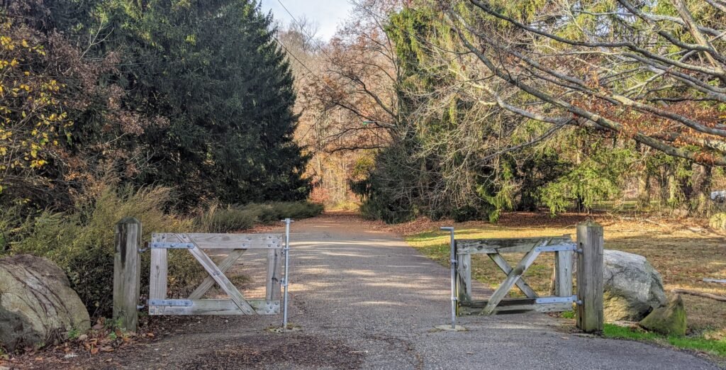
You’ll notice what looks like half of a gate – partially blocking the road, but not completely closing it – and a sign saying that vehicles are not allowed. A single lane, paved path heads up through the evergreen trees into the woods.
The path will turn to the left and begin to climb uphill. After a short while, the road will widen a fair bit so that it’s closer to two lanes.
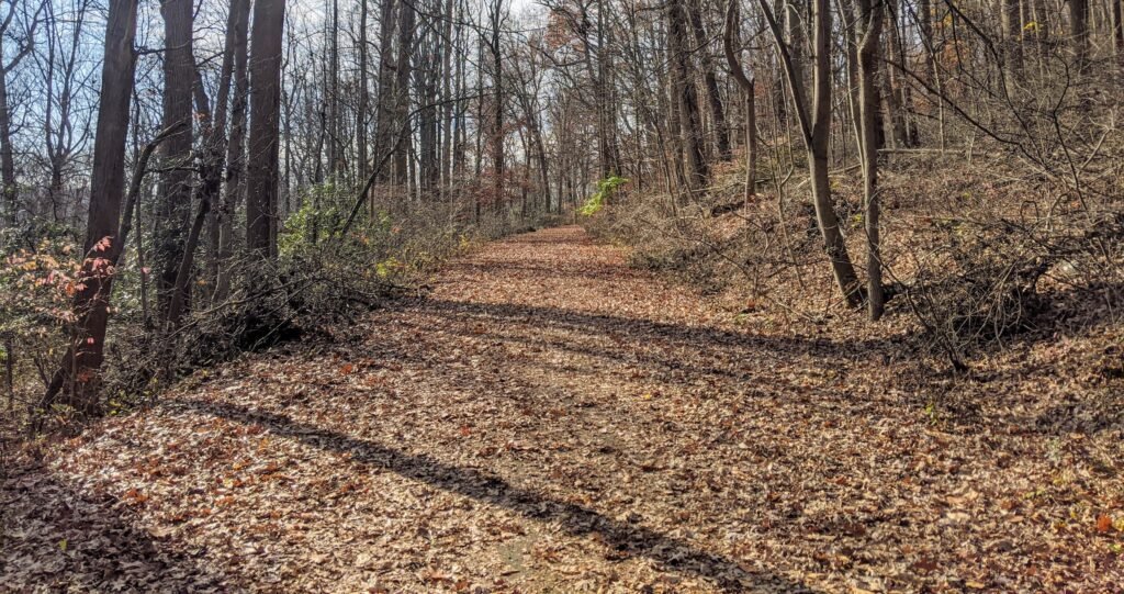
As you continue to climb, you’ll see the Orange Reservoir down to your left. You may also notice a hiking trail off the road on your right. The Elmdale Trail runs along Valley View Drive before climbing further up the mountain.
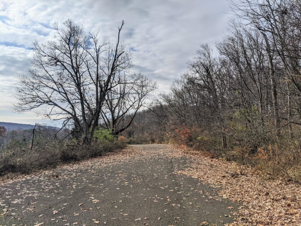
The road will continue to climb for about two thirds of a mile. It’s a moderate but steady incline – about 100 feet over that span. In the last third of a mile, the road flattens out and you’ll come to a wide open area. The trees on the left will disappear, and you’ll be able to look down and see Cherry Lane.
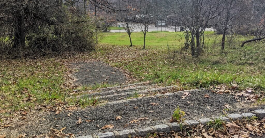
Towards the end of this open area, on the left, you’ll see a worn down set of steps. Follow these down the hill to the intersection – South Orange Ave and Cherry Lane. Cherry Lane turns into Brookside Drive after it crosses South Orange Ave, and the route continues from there.
If you were to turn around at the steps and look behind you, you’d see a path into the woods. It’s not well marked, but it will take you to the Oakdale Trail, and you could follow the red trail blazes from there.
Running Brookside Drive
After you cross South Orange Avenue, you’ll be on Brookside Drive. Until noon on Sundays, this is closed to vehicular traffic. If the weather is nice, you’ll likely see plenty of other runners, walkers, and cyclists on the road.
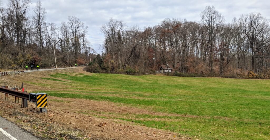
As you start down Brookside Drive, you’ll see two wide open, hilly areas on the right.
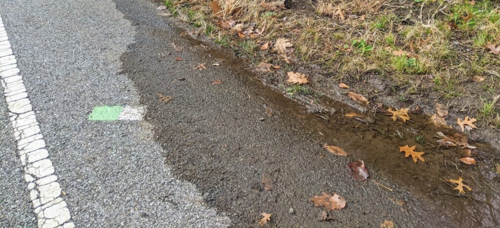
Towards the end of the second open area, you’ll see a green and white trail blaze. You can follow this to the right to join the Elmdale Trail or follow it to the left towards the River Trail (and many other trails).
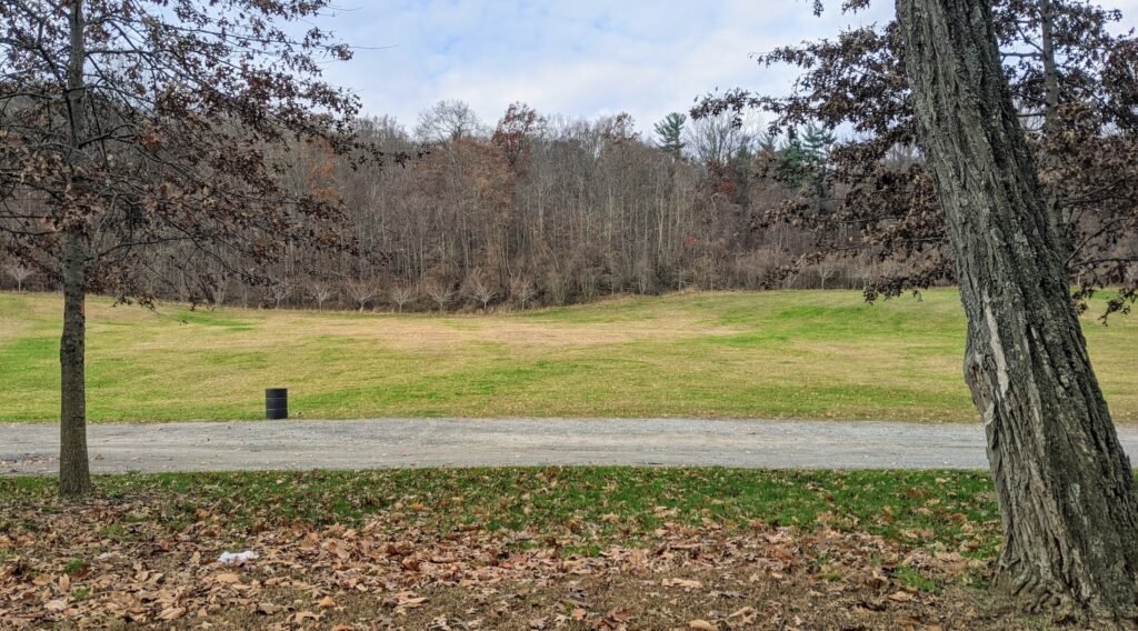
The first half mile or so will be a gentle decline. After a period of trees bordering the road on both sides, there will be a wide open expanse on the right. This is the Dogwood Hillside.
Shortly after you pass the Dogwood Hillside, the road will start to decline much more steeply. The trees will open up on the left, and there’s a vast open hill leading down from the road. This is Painter’s Point.
This is the steepest part of the run, and it drops about 100 feet over a quarter mile.
As you pass Painter’s Point, you’ll also see a blue and white trail blaze on the ground. Follow this to the right, and you’ll take a trail up to the Elmdale Trail.

As you continue down Brookside Drive, you’ll soon notice a small river to your left – the Rahway River. The river pools up into two ponds, before continuing south. The first of these is Campbell’s Pond. The second, smaller one, is Diamond Mill Pond.
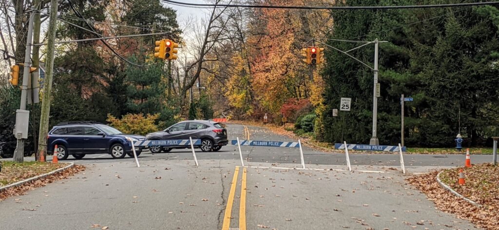
Once you pass Diamond Mill Pond, you know you’re almost done. There’s a final, small hill to descend, and as you turn a corner you’ll see the intersection with Glen Ave. The Millburn Police barricades mark the end of the section of Brookside Drive that’s closed to vehicles on Sundays.
If you were to look to the right at this intersection, you’d see the beginning of the Elmdale Trail, heading up on to the hill that looks down on Brookside Drive.
Options for Extending The Run
If you run this in one direction, it’s just short of 3 miles. A round trip, either way, would come out to about 5.5 miles.
If that’s long enough for your Sunday run, then this is a great workout by itself. The elevation gain is enough to be quite noticeable without being overly draining. You can take it easy or push yourself, depending on how you feel.
But I usually want to run a bit farther on a Sunday, so here are a few ideas for extending the run. I usually continue straight at Brookside Drive and Glen Ave to run past the Paper Mill Playhouse. Then I’ll turn left, loop back around by the Millburn Public Library, and head back up Glen Ave towards Brookside Drive. That adds about a mile.
Another option is to add in a few loops of the Orange Reservoir Loop. This is an easy 1.7 mile loop, and it’s across Cherry Lane from where Valley View Drive begins. If you want to add a significant amount of mileage, you can add in a few loops around the Reservoir.
Of course another option is to simply run the entire out and back route twice. That would be close to 11 miles, and you could still tack on some loops of the reservoir if you wanted a really high mileage day.
There are also a ton of trails you could connect to. At the end of Brookside Drive, you can take the blue Elmdale Trail back north. It will wind a bit, increasing the distance, and add quite a bit of elevation gain. You could also turn to the left down Glen Ave, turn left into the Reservation, and take the yellow Lenape Trail back north. This is even more windy and hilly than the Elmdale.
What Do You Think of Valley View and Brookside Drives?
This is one of my favorite Sunday runs. It’s not a proper “trail run,” since it’s on pavement the entire way. But I like being able to run through a natural environment, seeing trees and water alongside me, and not worrying about cars.
Check out this collection of trails in the South Mountain Reservation for other running trails to try out.
And if you’re interested in trail running, check out this guide to the what, how, and why of trail running.
I’m curious what you think about it. Have you run along Valley View Drive or Brookside Drive?
What did you think about it? Leave a comment below.