The South Mountain Reservation is home to a complex network of trails, including the Oakdale Trail and the Lenape Trail.
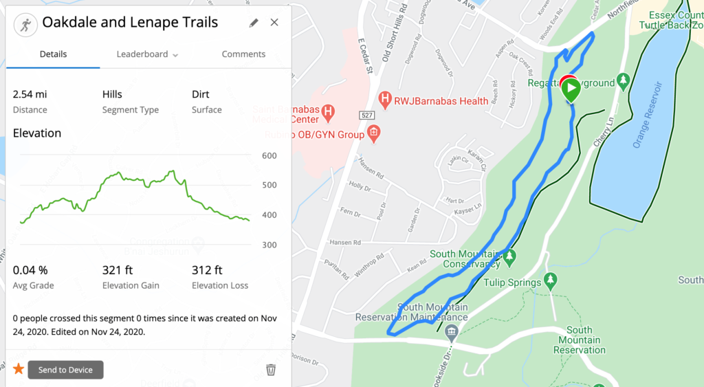
The Oakdale Trail connects two points on the Lenape Trail, forming a 2.5 mile loop that is a moderately difficult trail to run.
The loop is fairly hilly, and it includes substantial elevation gain over a short distance. It’s also well situated so that you can easily connect it to several other trails to extend your run. It’s a great short run by itself, and it can be a great building block for longer trail runs in the area.
Let’s explore the Oakdale and Lenape Trails.
Accessing the Oakdale Trail
The Oakdale Trail is a bypass trail, connecting the Lenape Trail to the parking area across from the Orange Reservoir Loop (see on Google Maps).
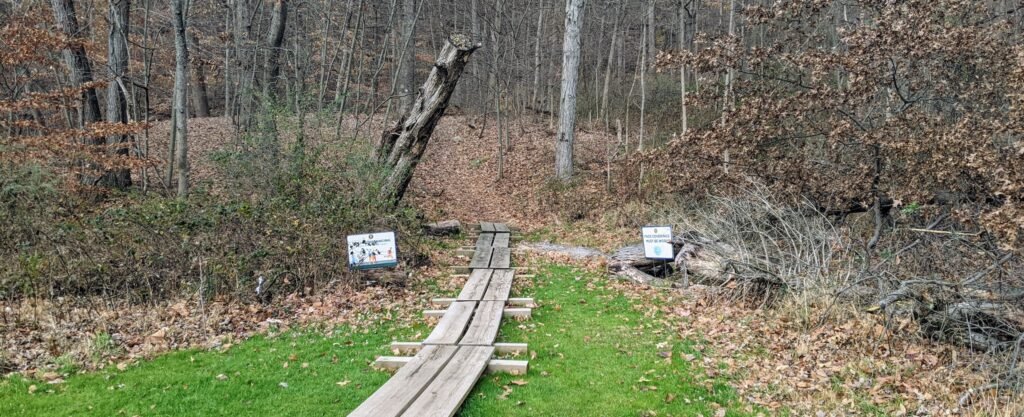
If you park at the parking lot and face away from Cherry Lane, you’ll see a small building with bathrooms. Behind that building is a set of wooden planks leading into the forest. This is a major access point to the Oakdale Trail, and the only convenient parking location.
The actual trailheads where the Oakdale Trail begins and ends are located along the Lenape Trail. If you’re following the Lenape Trail north, there will be a trailhead for the Oakdale Trail shortly after you cross Cherry Lane near the intersection with South Orange Avenue.
If you’re traveling south, you’ll encounter a trailhead shortly after crossing Northfield Avenue and before you get to the Crag.
You can also access the Oakdale Trail from Valley View Drive. The two trails run parallel to each other, and at the southern terminus of Valley View Drive there’s a small opening in the woods leading to the Oakdale Trail.
Finally, there’s an obscure trail leading west from the intersection of Northfield Ave and Cherryl Lane that will take you to the Oakdale Trail. It’s overgrown with vegetation, especially in the summer. I tried to find it once, and I couldn’t. However, when you’re on the Oakdale Trail you’ll see where it exits towards Cherry Lane.
Exploring the Oakdale and Lenape Trails
Now that you know how to get there, let’s explore the Oakdale Trail and the Lenape Trail. I started my run from the parking lot across form the Orange Reservoir Loop.
The planks will cross over a low section, which tends to get muddy. You’ll quickly get to an intersection where you can go to the right or the left.

The trail will loop back around, so you can go either direction. If you go left, the incline is spread over a longer distance than if you go to the right.
I chose to go to the left and head south. The trail travels along Valley View Drive, and you’ll soon be able to see it on your left.

If you look to your right, you’ll see a tall hill leading away from the trail. I hope you’re ready for a good climb, because the second half of the loop is on top of that hill!
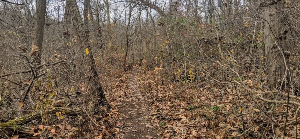
The trail will continue straight for a while, and it’s very easy to follow. There’s a general uphill trend, although it rolls up and down a bit.

A little under a mile into the run, you’ll come to the southern end of the trail. You’ll see Valley View Drive open up to your left, and beyond it will be the intersection of Cherry Lane and South Orange Avenue. You could take this left to connect with the Lenape Trail heading south or to run along Brookside Drive.
However, to continue along the loop we’re taking, turn to the right. You’ll soon come to a red trail head marking the official beginning / end of the Oakdale Trail.
There’s also a signpost with a map and a yellow blaze for the Lenape Trail.
The Lenape Trail will climb through the woods to the top of that big hill we saw before. This part is quite steep, and you’ll climb about 100 feet in a little over a quarter mile.
If you want a good workout, try and take it fast. Otherwise, don’t be afraid to take it slow. There are plenty of other shorter hills that you can charge up.

As you climb the hill, the Lenape Trail will turn to the right. There is another trail, the West Ridge Trail, that continues straight and turns left towards South Orange Avenue.
Continuing along the Lenape Trail, you’ll notice blue blazes on the tree as well as the usual yellow blazes. The map doesn’t indicate what trail this is, and the blazes are relatively faded, so I’m guessing this was an old trail that was incorporated into the Lenape Trail.
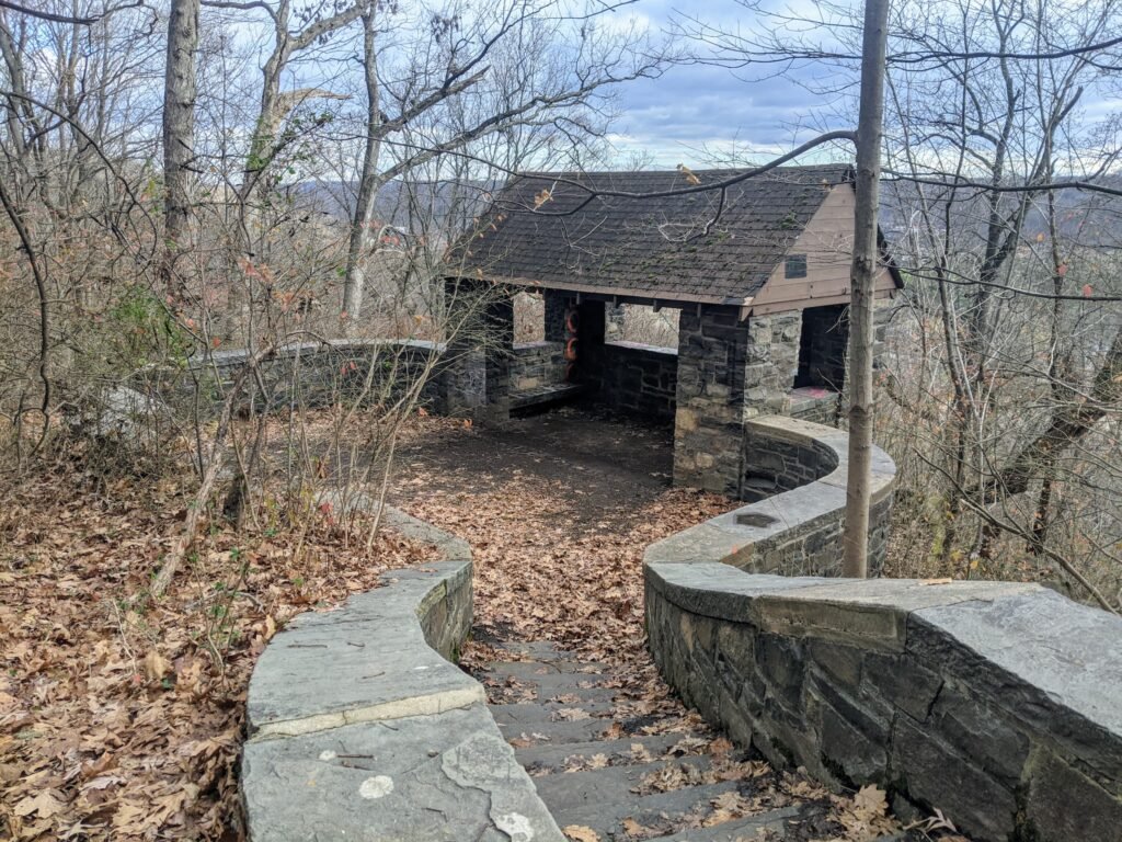
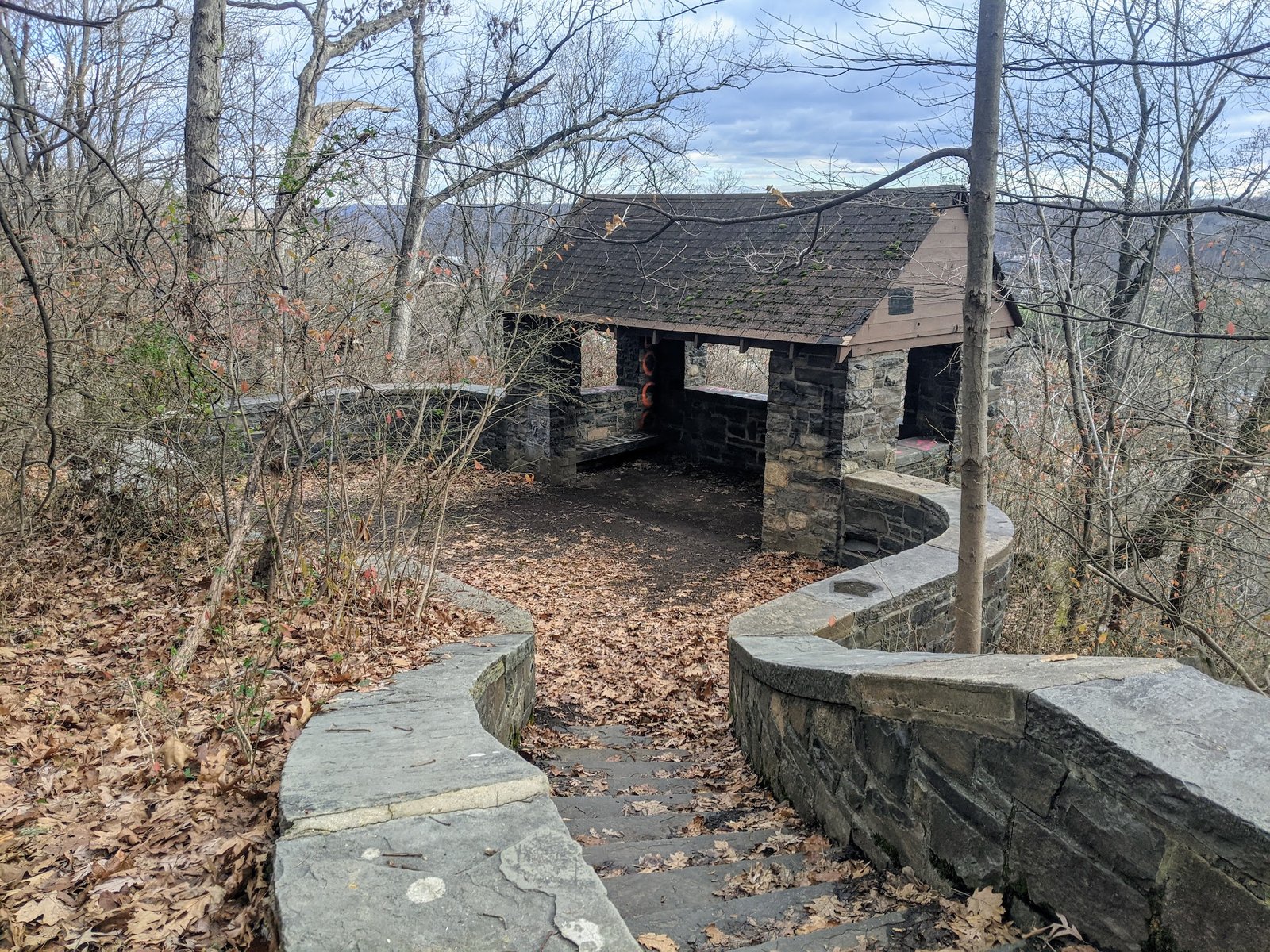
About a mile after you join the Lenape Trail, you’ll come across a small shelter on the righthand side of the trail.
The building is a little run down, and there’s some graffiti. It’s a shame it’s not kept up better, but it offers a decent scenic overlook. From here, you can see out over the Orange Reservoir and the rest of the South Mountain Reservation.
If you’re tired after climbing the hills, this is a good spot to pause for a moment and catch your breath. This spot is named “The Crag,” and it’s marked on local maps and on Google Maps. I can’t find any history about it, though, which leaves me a little curious.

Shortly after passing the overlook at The Crag, the trail will split. You can continue left along the Lenape Trail, and this will lead you across Northfield Ave to the Mayapple Loop Trail.
To continue on our loop, take the trail branching off to the right. I didn’t see an obvious trail head marking the beginning of the Oakdale Trail, but there were some red blazes.
As the Oakdale Trail approaches Northfield Ave, it will turn to the right and begin traveling downhill. Taking the path to the left will connect you back to the Lenape Trail.
The trail will continue along Northfield Avenue for a very short while, and it will then turn sharply to the right. The trail will descend rapidly and double back on itself.
This is pretty steep, and one of the reasons why I chose to go up the other way. If you took a right turn at the beginning of the trail, you’d have to go up this hill!
After you make it to the valley floor, the trail flattens out. It’s pretty even from here on out. There’s a right turn that’s easy to miss, because there seems to be a trail leading straight ahead.
This unmarked trail will take you back to the intersection of Northfield Ave and Cherry Lane.
You should also be warned that there are quite a few rocks along this part of the trail. Be careful of your footing, so you don’t trip or twist your ankle.
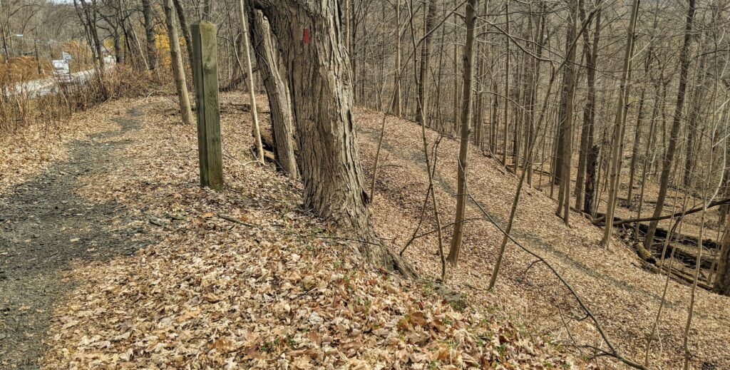
After you take that last turn, be on the look out for the exit. It’s not much farther, and it’s not well marked. I’ve almost run right by it several times!
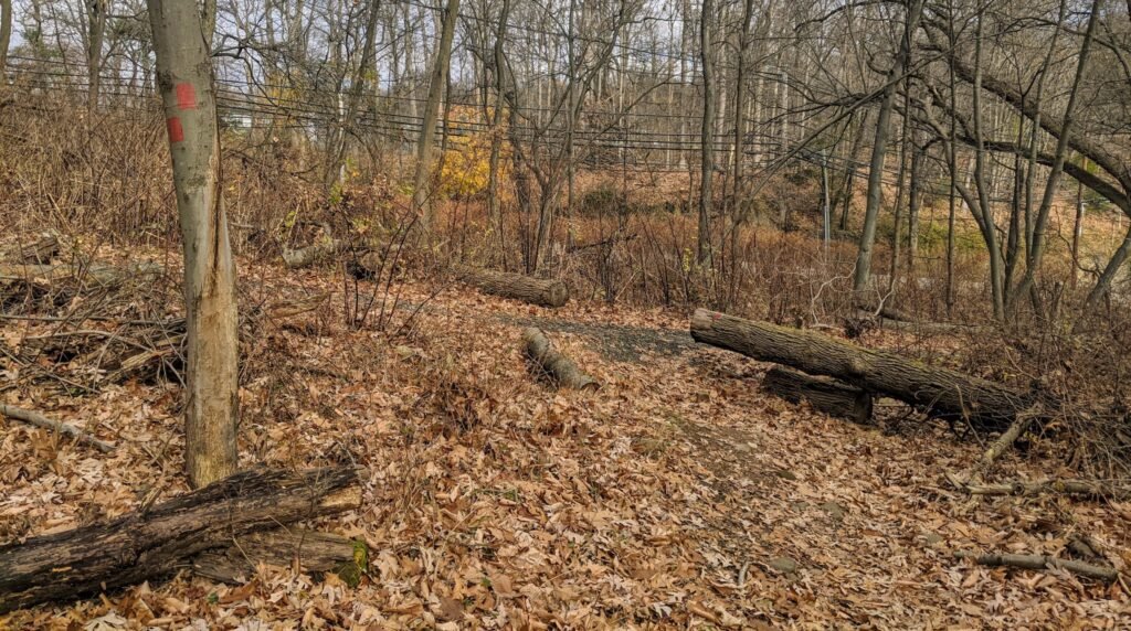
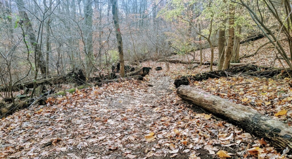
You’ll see the same log on the ground that we saw on the way in, with red arrows painted on it. Take a left turn here to exit the trail and find yourself back in the parking lot.
Final Thoughts on the Oakdale and Lenape Trails
This is a great run. It has a few challenging inclines, so you’ll get a good workout, but it has plenty of flatter sections interspersed so that you can catch your breath.
While the loop itself is a bit short – 2.5 miles – it’s easy to add additional mileage.
You could follow the Lenape Trail north and loop around Mayapple Trail to add another two miles or so. You could run the loop twice, which would bring the total mileage up to a respectable five miles.
Another option is to cross Cherry Lane into the Orange Reservoir Loop. Here, you can either do an easy run around the reservoir, or you can take the Zoo Loop Trail to connect to other trails in the reservation.
Be aware that the trail is narrow at points, and when the vegetation is grown in it will encroach on the path. This is an easier run in the fall and winter than it is in the summer.
There are also a lot of rocks jutting up from the trail. It’s not particularly treacherous, but you do want to be careful of your footing. I definitely tripped once, but I managed to regain my footing before I fell on my face.
There are a few parts that are susceptible to flooding and getting muddy. The trail wouldn’t be impassible after heavy rain, but it would definitely be messy.
Check out this collection of trails in the South Mountain Reservation for other running trails to try out.
And if you’re interested in trail running, check out this guide to the what, how, and why of trail running.
I’m curious what you think about it. Have you run along the Oakdale and Lenape Trail Loop?
What did you think about it? Leave a comment below.