
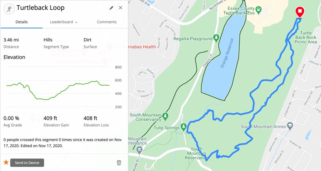
The South Mountain Reservation is home to a complex network of running trails, including the Turtleback Loop Trail.
The Turtleback Loop is a moderate difficulty, hilly trail through the northeastern end of the Reservation. It’s mostly single track, dirt trails, and it has about 400 feet of elevation gain over 3.5 miles.
It’s a great trail to run by itself, and it can easily be combined with other trails to construct a longer run.
Let’s explore the Turtleback Loop trail.
Accessing the Turtleback Loop Trail
You can access the Turtleback Loop from a number of different areas.
I started my run from the northeast part of the loop, near the Turtleback Rock Picnic Area (see on Google Maps). It’s not directly accessible from the parking lot, but if you start down the Interpretive Trail (the orange and white blazes) you’ll intersect the Turtleback Loop Trail within a few hundred meters.
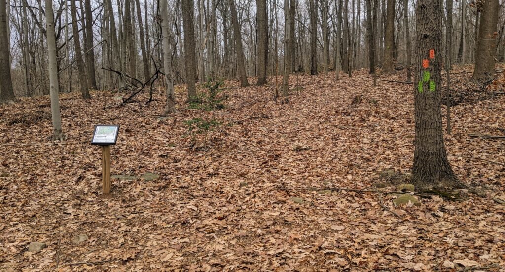
The Interpretive Trail has two starting points from the parking lot. Use the one further south (to the left) that starts by the sign. There’s a signpost with a map where the Interpretive Trail meets the Turtleback Loop Trail.
You can also park at Tulip Springs (see on Google Maps). From the parking area, you’ll see an entrance into the woods with a set of steps. There will be two trail blazes – the Yellow Lenape Trail and the Orange / Green Reservoir Connector Trail. At the steps you can either continue straight to take the Turtleback Loop counter-clockwise or turn left to take the Turtleback Loop clockwise.
You can also access the Turtleback Loop trail from a number of other trails, including the Zoo Loop, the Orange Reservoir Loop, and the Reservoir Connector Trail.
Exploring the Turtleback Loop
You can start the Turtleback Loop Trail from several places, and I chose to start near the Turtleback Rock Picnic Area.
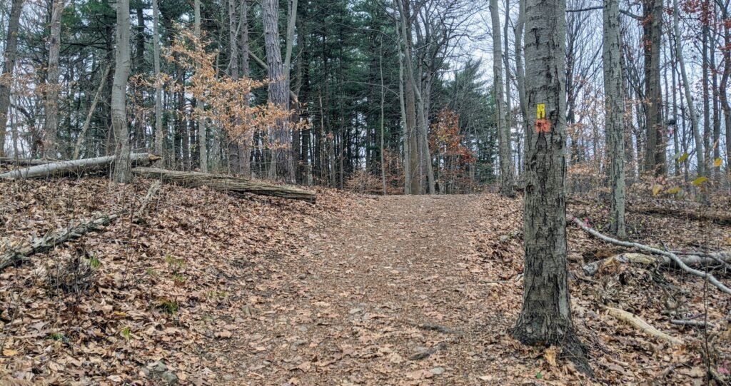
I started along the Interpretive Trail, using the southern trailhead that starts the loop clockwise. A few hundred meters into the woods, I saw the first orange trail blaze for the Turtleback Loop. Note that at some points the orange blaze is dark and looks almost red.
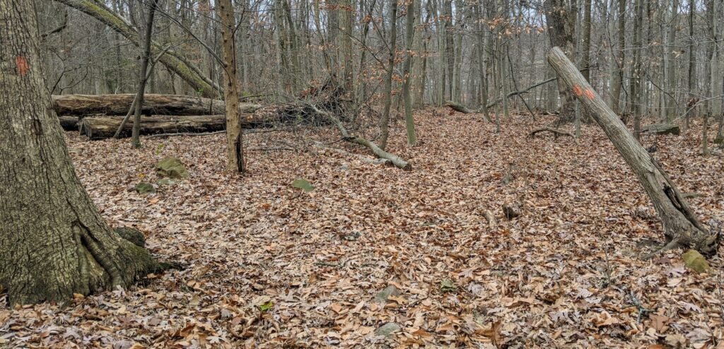
I continued on just a little bit farther, to where the Turtleback Loop and the Interpretive Trail split. I took the left turn pictured above and headed south.
From here, the trail narrowed a bit. Much of the trail is single track, but this part along the edge of the hill was particularly narrow.
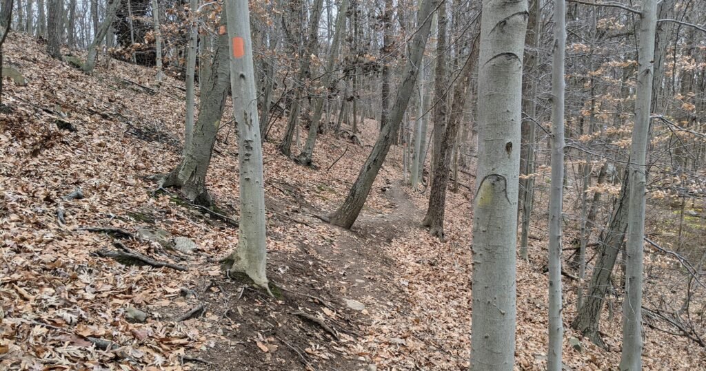
It sloped down fairly steeply to the right, and you should be careful of your footing here. I continued along a ways, and it eventually flattened out.

You’ll pass a stone on the ground with a green trail blaze. This marks the Connector Trail, which connects two points on the Turtleback Loop.
If you turn to the left, you’ll see the green trail head. Take that trail and you’ll end up on the other side of the Turtleback Loop. If you want to cut the loop short, this will get you back to where you started.
Continuing along the Turtleback Loop, you’ll eventually come to a gravel road. This carriage road is the Reservoir Trail. There’s a post at the intersection with an orange trail blaze, and the Turtleback Loop continues straight ahead.
If you turned right, you’d soon end up on the Zoo Loop Trail. If you turned left, you’d eventually hit the Lenape Trail.
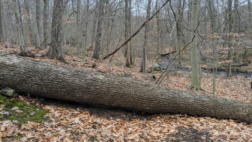
The trail descends steeply into a valley, at the bottom of which is a stream flowing south from the Orange Reservoir. There’s a large tree fallen on the trail here, but you can walk around it to continue on the trail.

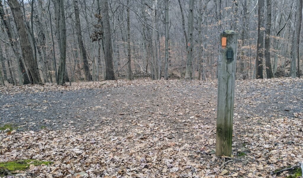
As you walk along the stream, you’ll see a post with a map on it. You may also notice an orange and green blaze. This is the Reservoir Connector trail.
If you crossed the stream on that line of rocks, you can take the Reservoir Connector trail back to the Orange Reservoir Loop. In the other direction, the Reservoir Connector trail will follow the Turtleback Loop trail until it hits the Lenape Trail.
Soon, the trail will get narrow again, and there will be a steep drop on the right side down to the stream. While this isn’t too treacherous, the amount of leaves on the trail did make me nervous. I walked a few short parts rather than risk a slip and a fall.
You’ll soon come to an intersection with a parking lot off to the right and the trail continuing to the left. This is Tulip Springs. You could have parked here and joined the trail at this point.
This is also where the Turtleback Loop Trail and the Lenape Trail meet. Follow the trails to the left, and you’ll see the orange blazes and the yellow blazes together.

The next bit of trail is an interesting change of scenery. Most of the South Mountain Reservation has deciduous trees. This section of the trail has tall, thin evergreen trees. There are pine needles covering the forest floor instead of leaves.
There’s something a bit eerie about it.

Continue further along the trail until you come to another major intersection. If you look to the right, you’ll see a bridge that crosses over South Orange Avenue. This bridge follows the Lenape Trail into the southern part of the reservation.
Instead, Follow the orange blaze ahead to stay on the trail.
As you follow the trail, pay particular attention to the trail blazes. At one point, the trail will split and follow two paths. This will be followed by a sharp turn to the left.
In the past, I’ve missed this turn. If you do, you’ll end up on a carriage road that will eventually turn left and head back towards the Turtleback Rock Picnic Area.
The trail will climb fairly steeply, and it will double back on itself. Again, pay attention for the trail blaze or you might get confused.
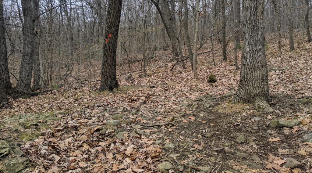
Further along the Turtleback Loop Trail, you’ll come to another set of green trail blazes. This is the other half of the Connector Trail.
Around this area, you may also notice an orange and white trail blaze. This is the Turtleback Bypass. Although it’s the same colors, it’s a different trail from the orange and white blazed Interpretive Trail.
The Turtleback Bypass is just that – a short bypass that leaves and then re-joins the Turtleback Loop Trail. If you look at the map on the signpost, you’ll see the trail marked there.
From here on out, the trail is fairly flat and uneventful. There are a few small ups and downs, but no major changes in elevation.
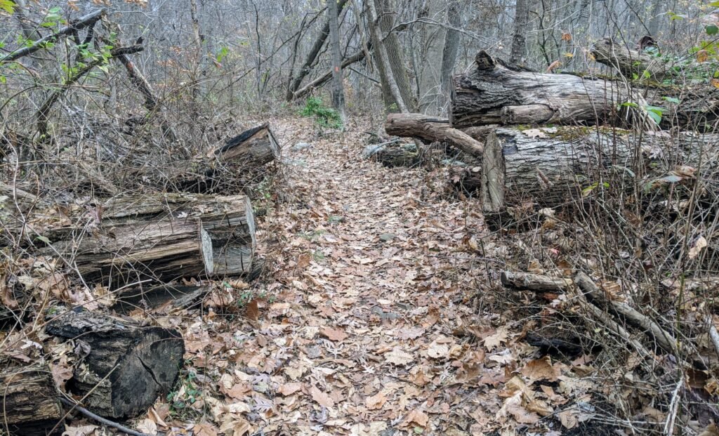
Soon, you’ll pass by a few areas with trees that fell long ago. Someone had a lot of fun with a chainsaw trying to keep this trail clean.
You’ll cross over a series of carriage roads and you’ll see houses off to the right on the edge of the woods. This means that you’re almost back to where you started.
When the trail intersects with the Interpretive Trail, you’re back at the beginning. You can turn to the right to return to the Turtleback Rock Picnic Area.
Final Thoughts on the Turtleback Loop Trail
The Turtleback Loop Trail is a great moderately difficult trail.
It’s long enough (3.5 miles) and has enough elevation gain (400 feet) to make for a good trail run by itself. By the time I jog over to the trail and back to my house, that’s a little closer to four miles.
It’s also very easy to add additional miles by joining it with other trails. I ran along the Interpretive Trail to add almost a mile to my run. This put me at 5 miles – my goal for a good weekday trail run.
If you want a truly long run, you can take the Lenape Trail south across South Orange Avenue. By the time you loop back north, you can easily cover 10 or 12 miles. I do this sometimes on a Sunday, when I don’t want to run along Valley View and Brookside Drives.
This trail is probably a little long and difficult for true beginners and small children. But someone with a little experience hiking can easily do this loop in less than two hours.
Two of my favorite parts of this trail are the stream coming out of the reservoir and the portion that travels through the stand of evergreen trees. The water is calming, and walking through the evergreens feels like I’ve been transported to somewhere else.
If you’re looking for other running or hiking trails in the area, check out my other posts about trails in the South Mountain Reservation.
And if you’ve never tried trail running, check out this guide to trail running.
Have you gone running or hiking along the Turtleback Loop Trail? I’d love to hear what you thought about it. Leave a comment below.